
Maps and Guides
Shuswap Region / Guides and Maps
Welcome to your complete guide to exploring the South Shuswap and surrounding region. Whether you’re planning a boating adventure on Shuswap Lake, searching for hiking and cycling trails, discovering local wineries, exploring scenic driving routes, or planning a winter getaway, these maps and guides will help you make the most of your visit. Explore Blind Bay, Sorrento, Eagle Bay, White Lake, Tappen, Sunnybrae, Salmon Arm, Sicamous, and communities throughout the Shuswap with resources designed for visitors, residents, and outdoor enthusiasts alike.
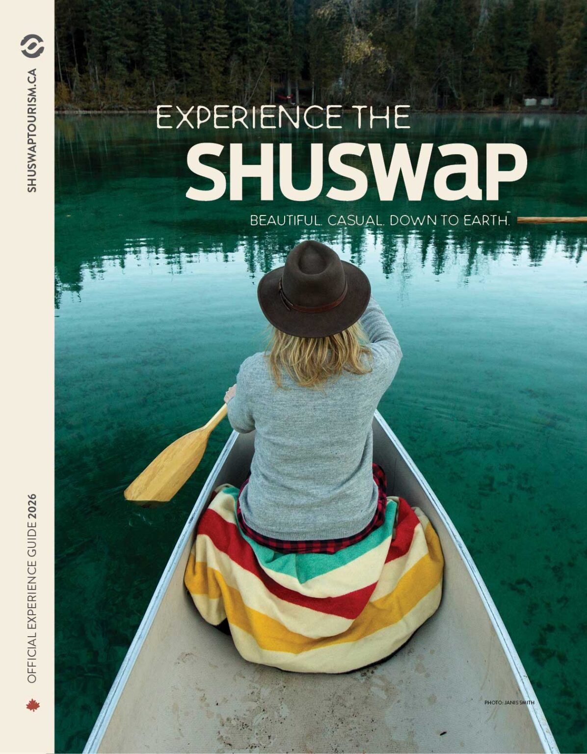
Experience the Shuswap 2026 Visitor Guide
Discover the best of British Columbia’s Shuswap region with the official Experience the Shuswap 2026 Visitor Guide. Whether you’re planning a weekend getaway, summer vacation, road trip, outdoor adventure, or year-round escape, this comprehensive guide is your gateway to everything the Shuswap has to offer.
Explore the vibrant communities of Blind Bay, Sorrento, Eagle Bay, White Lake, Tappen, Sunnybrae, Salmon Arm, Sicamous, Chase, Falkland, Enderby, and the North Shuswap. Find insider recommendations on accommodations, restaurants, shopping, arts and culture, local events, family attractions, wineries, breweries, farmers markets, golf courses, and unique experiences throughout the region.
Known for its stunning lakes, welcoming communities, and endless outdoor recreation opportunities, the Shuswap offers over 1,000 kilometres of shoreline, scenic hiking and biking trails, paddling routes, fishing destinations, wildlife viewing, winter recreation, and unforgettable road trips. Visitors can enjoy boating on Shuswap Lake, explore local museums and galleries, attend festivals and live music events, discover Indigenous culture and history, and experience the authentic hospitality that makes the region one of British Columbia’s favourite destinations.
The Experience the Shuswap 2026 Visitor Guide is an essential resource for discovering hidden gems, planning adventures, supporting local businesses, and creating lasting memories in one of Canada’s most beautiful lake destinations. Whether you’re a first-time visitor or a returning guest, this guide will help you experience the very best of the Shuswap in every season.
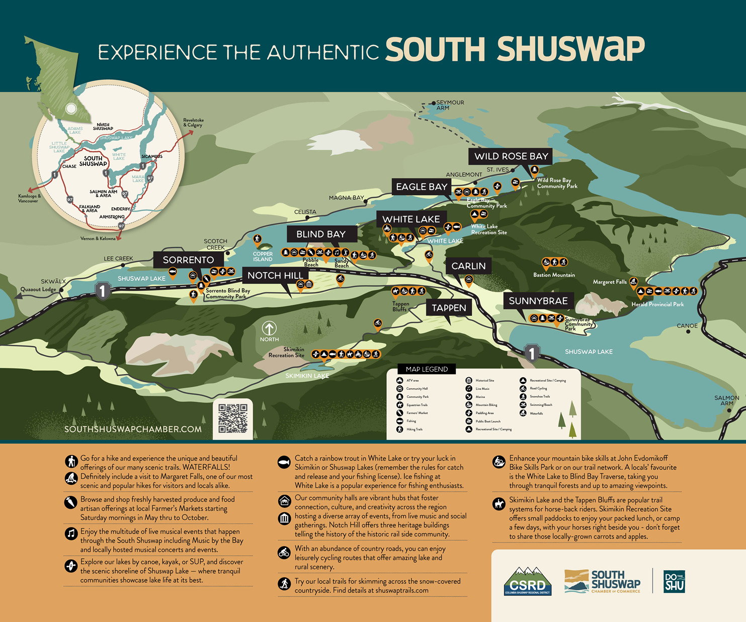
Explore the Authentic South Shuswap
This visitor map highlights the diverse communities, attractions, parks, trails, beaches, recreation sites, and local experiences that make the South Shuswap one of British Columbia’s most welcoming destinations. Stretching from Sorrento and Blind Bay through White Lake, Eagle Bay, Sunnybrae, Tappen, Notch Hill, and Wild Rose Bay, the region offers endless opportunities for outdoor adventure, cultural experiences, and lakeside relaxation.
Use this map to discover hiking and biking trails, community parks, beaches, boat launches, marinas, farmers’ markets, fishing locations, live music venues, historic sites, and family-friendly attractions. Whether you’re exploring Shuswap Lake by boat, enjoying local events, cycling scenic backroads, paddling quiet bays, or discovering hidden gems throughout the countryside, the South Shuswap offers authentic experiences for every season.
The map also showcases the unique character of each community while helping visitors navigate the region’s many recreational opportunities, local businesses, and visitor services. Download a digital copy or visit one of our visitor information kiosks to begin planning your South Shuswap adventure.

Explore Shuswap Lake with confidence using the official On the Water Map. This essential boating guide highlights marinas, boat launches, fuel docks, beaches, provincial parks, popular destinations, navigation information, and waterfront communities throughout the Shuswap. Perfect for boaters, paddlers, anglers, and visitors looking to discover the lake’s most scenic locations.

Discover some of the best hiking, walking, cycling, and outdoor recreation opportunities in the Shuswap with the Shuswap Trail Alliance Trail Guide. Featuring trails for all skill levels, the guide helps visitors explore forests, lakeshore routes, scenic viewpoints, waterfalls, and family-friendly outdoor adventures throughout the region.

Experience the flavours of the Shuswap with the Sip the Shuswap Guide. Discover local wineries, craft beverages, farm markets, artisan producers, restaurants, and unique culinary experiences throughout the region. A perfect resource for visitors looking to enjoy local food, wine, and authentic Shuswap hospitality.

Explore the Shuswap by bike with detailed cycling routes, mountain biking trails, and scenic recreational pathways. The Bike Trail Map helps riders of all experience levels discover some of British Columbia’s most beautiful cycling opportunities while connecting communities, parks, and outdoor attractions throughout the region.

Plan your next cycling adventure with the Shuswap–North Okanagan Cycle Guide. Featuring road cycling routes, scenic touring opportunities, local attractions, community highlights, and rider-friendly stops, this guide showcases the incredible landscapes that connect the Shuswap and North Okanagan regions.

Take the scenic route and discover the beauty of British Columbia’s interior with the Motor Touring Guide. Explore winding lakeside roads, mountain viewpoints, charming communities, cultural attractions, historic sites, and unforgettable road trip experiences throughout the Shuswap and surrounding regions.

Winter adventure starts here. The Shuswap XC Ski and Snowshoe Guide highlights cross-country ski trails, snowshoe routes, winter recreation areas, and outdoor experiences throughout the region. Discover groomed trails, breathtaking winter scenery, and family-friendly activities for all ages.

Discover the Shuswap’s premier Nordic skiing destinations with detailed information on trail networks, winter recreation areas, facilities, and seasonal conditions. Whether you’re an experienced skier or trying Nordic sports for the first time, this guide will help you make the most of winter in the Shuswap.